Met-ocean study for the design of the Polar Pod structure and the optimization of its route

As part of Jean-Louis Etienne’s expedition to explore the Southern Ocean aboard the Polar Pod, an inhabited oceanographic platform specially designed to drift around Antarctica in the “howling fifties”, NOVELTIS carried out an advanced scientific study of the met-ocean parameters on the Polar Pod’s planned route.

The aim of the Polar Pod project is to improve our knowledge of the Southern Ocean through the path taken by the developed drifting structure. NOVELTIS has been asked to contribute to the design and dimensioning of this innovative structure and to provide a detailed analysis of the met-ocean conditions and risks in this relatively unknown area around Antarctic.
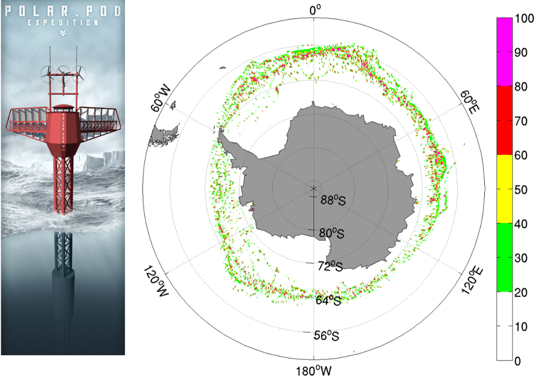
Polar-Pod Figure
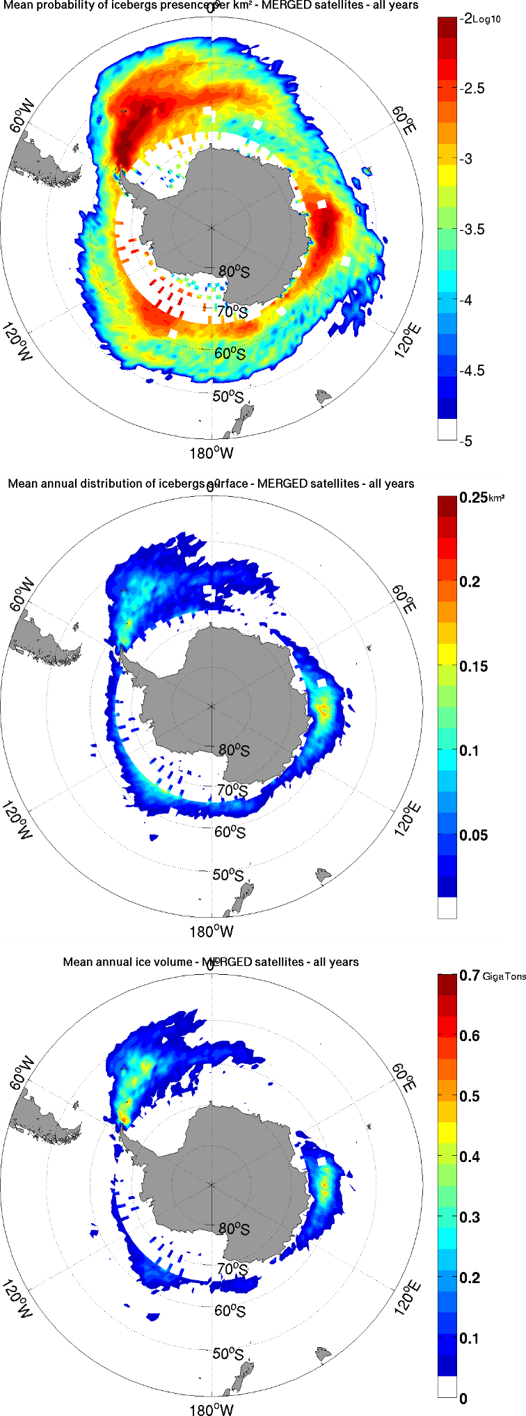
Polar-Pod figures

Left: Illustration of the “Polar Pod” platform and graph of average monthly ice accretion levels between 1979 and 2010 over the whole of Antarctica for the month of October.

Right: Average probability of floating ice (high). Surface distribution of floating ice per km2 (middle). Mean volume in GT of floating ice (bottom).

The Polar Pod will drift around the Antarctic and may therefore be subject to several risks, particularly those linked to the presence of floating ice on its route. NOVELTIS has therefore developed an innovative and reliable methodology to characterize these risks, through the processing of multi-source data (satellites, models, climatology, etc.) and unique indicators related to ice volumes, their probability of presence, the spatial coverage of icebergs, etc.

Means used

  • New met-ocean models
  • Innovative algorithms for risk characterization in the Southern Ocean
  • Advanced scientific analysis
  • Compliance with international standards (e.g. DNV-OS-J101)

Résults

  • A complete met-oceanic analysis and unique indicators on the Polar Pod expedition area in the Southern Ocean.
  • Recommendations for the design of the Polar Pod.

Client / Partner(s)

Jean-Louis ETIENNE